The Survey Station
Selected Projects | | Links: Link to website
This website covers the activity of survey mark hunting and provides resources for amateur hunters and professional surveyors, in addition to maps and digital archives.
- Overview
- Project type
- Roles & responsibilities
- Technologies used
- Deployment method
- Related documentation & case studies
Overview
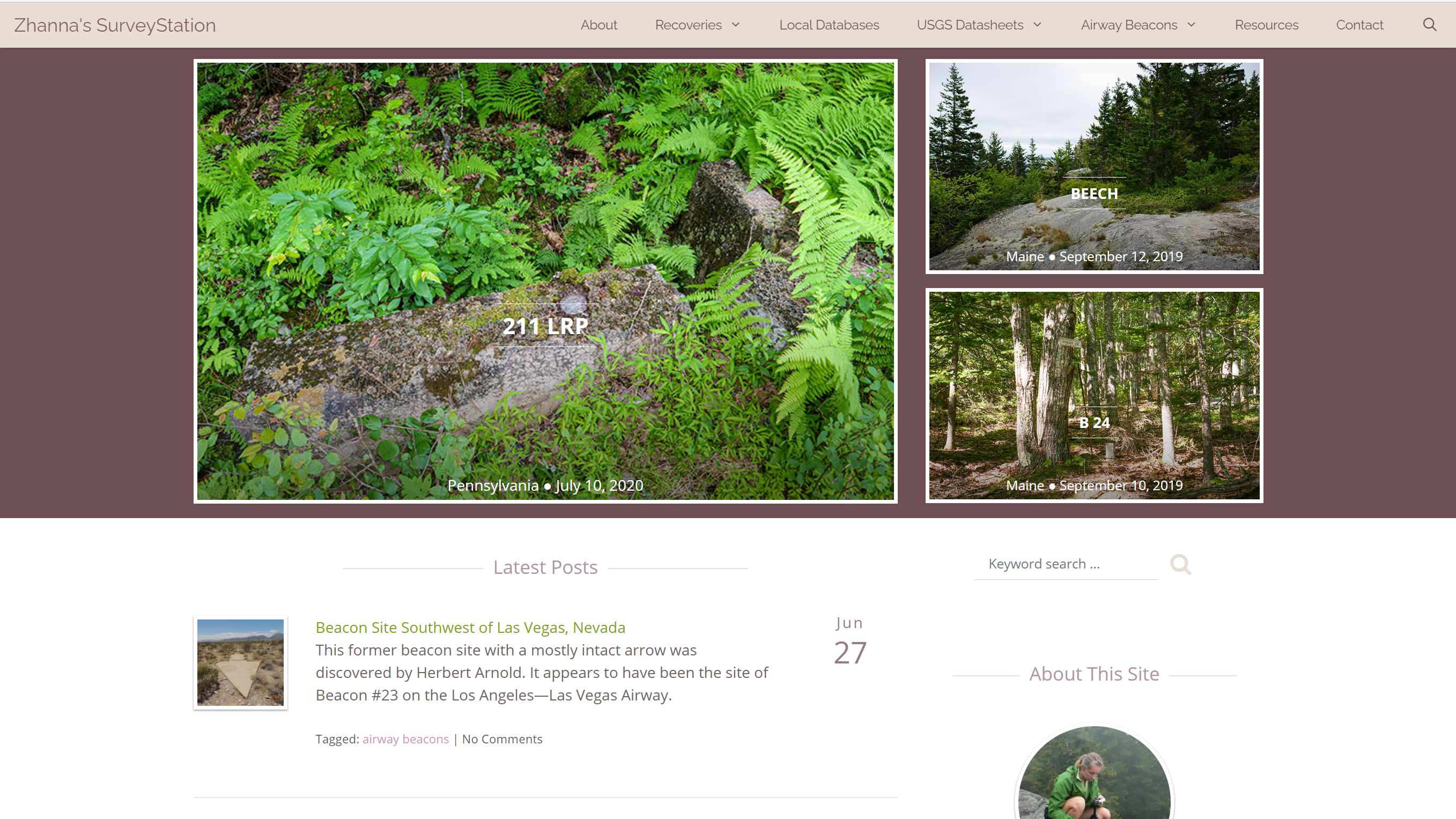
TheSurveyStation.com serves as a home base for survey mark hunting enthusiasts, in addition to being a resource for professional surveyors. It provides documentation of survey mark recoveries across the United States, support for surveyors and mapping/geography enthusiasts, and a library of historical airway beacon mapping and information. The website contains an archive of historical USGS survey mark datasheets – never before available in digital format, these datasheets provide a window into landmarks and land ownership during the late 19th and early to mid-20th centuries in America. The website also provides over 6GB of National Geodetic Survey (NGS) data and documents.
Via this website, a vibrant community has developed around documenting and reconstructing old airway beacons. Additionally, although the survey mark documentation is primarily done by amateurs, professional surveyors have used the resulting data to assist them in their work.
For more details on the motivation behind this website, see About Survey Mark Hunting.


![]()

A selection of screenshots from TheSurveyStation.com
Project type
Website
Roles & responsibilities
Primary Role
Website Developer
Responsibilities
- Application development
- Asset creation
- Content creation
- Server and website administration & maintenance
- Systems integration
- Website design & development
Technologies used
- Self-hosted WordPress instance on virtual private server (VPS).
- PHP for custom template development, on top of the GeneratePress theme framework.
- Development and extensive use of custom fields and custom post types to create survey mark database within WordPress.
- Integration of Leaflet open-source JavaScript mapping library for displaying survey mark and airway beacon locations on maps.
- Custom scripting to dynamically create GeoJSON file of survey mark recoveries for mapping.
- Custom search by survey mark attributes, plus integrated keyword searching of website content.
- WordPress REST API to output consistently formatted header and footer to integrate Apache directory listing into website.
- Backups performed daily by iControlWP WorpDrive service.
Deployment method
- Local development on XAMPP server, then migrate changes to WordPress instance.
- Textual content created directly in WordPress CMS.
Related documentation & case studies
- Adding a Virtual Host for Local Development
- Trying the WordPress REST API
- Jennifer Galas and Donna Witek, The Information Literacy of Survey Mark Hunting: A Dialogue, In the Library With the Lead Pipe, November 9, 2016.