Acadia Hidden Features Map
Selected Projects | | Links: Link to application
This interactive map accompanies a hiking guide, providing GPS and route-finding data for parking and hike locations.
- Overview
- Project type
- Roles & responsibilities
- Technologies used
- Deployment method
- Related documentation & case studies
Overview
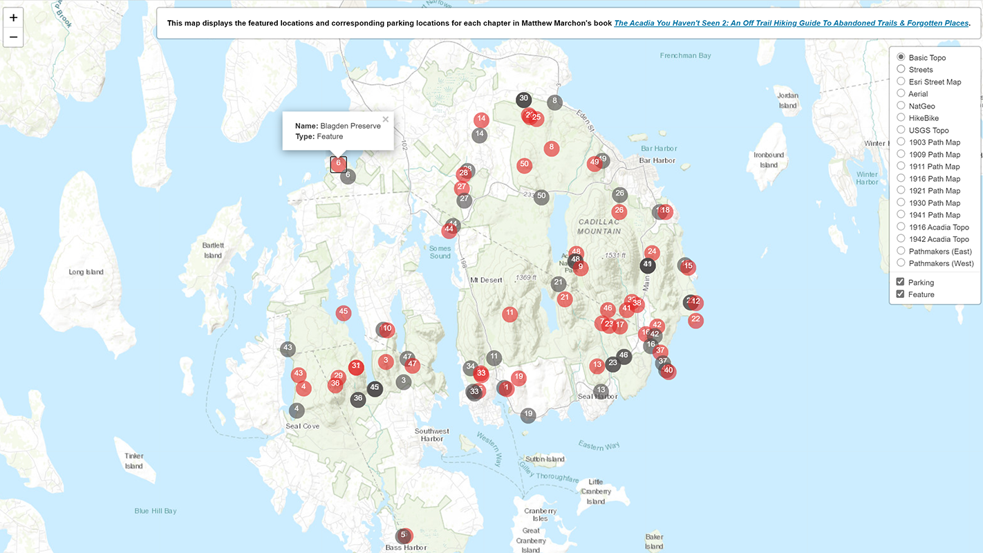
The Acadia Hidden Features Map was built to accompany The Acadia You Haven’t Seen Volume 2: An Off Trail Hiking Guide To Abandoned Trails & Forgotten Places by Matthew Marchon. This interactive map features hiking and parking locations keyed to the chapters in the book. The map can be filtered by type of location and currently features 18 different basemaps (many of which are historical).
Technologies used include the open-source mapping library Leaflet for map rendering and display, and GeoJSON for encoding and storing the geographic data. I also georeferenced most of the historical basemaps myself using MapWarper.
The map is intended to make it easy for users of the hiking guide to find the features nearest to their current location, or to certain other locations, when they are in the field. The book does not group hikes by location, so it is difficult to know what other features are nearby when driving or hiking around Mount Desert Island. Parking locations appear on the map too, making it easy to use with a vehicle navigation unit or other GPS-enabled device.
Project type
Application
Roles & responsibilities
Primary role
Application Developer
Responsibilities
- Application development
- Website development
Technologies used
- Leaflet open-source JavaScript mapping library for displaying feature/hiking locations and parking locations on map.
- GeoJSON file to store geographic data.
- Integration and customization of Leaflet plugins (ESRI and MapCenterCoords) to add enhanced features.
- 18 basemaps showing current and historical geographic data that can be swapped out on the fly.
- Historical MDI/Acadia Path Maps and topographic maps (1903-1942) georeferenced on MapWarper.
- Dynamically generated, filterable map markers with numbers corresponding to the book chapters.
- Popup windows for each map marker that give more information about the type of location.
Deployment method
- Local development in Git repository, STFP upload to server.
Related documentation & case studies
- Matthew Marchon, The Acadia You Haven’t Seen Volume 2: An Off Trail Hiking Guide To Abandoned Trails & Forgotten Places, 2019.