Abandoned MDI Map
Selected Projects | | Links: Contact for access
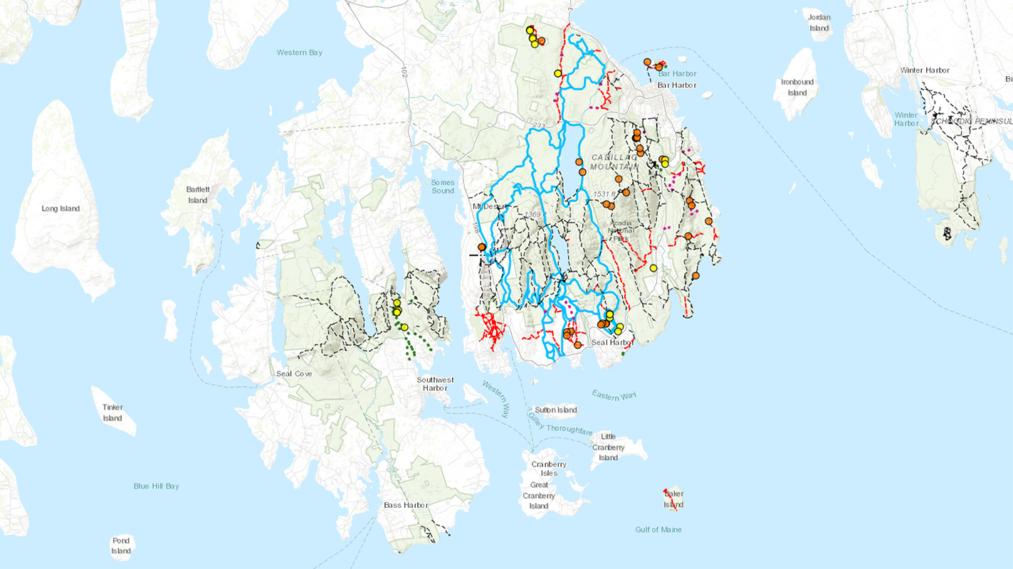
This interactive map catalogs little-known trails and features of Mount Desert Island, Maine, and displays them alongside official National Park Service trails.
Overview
The Abandoned MDI Map was built to give me a visual overview of the unpublished trails and features on MDI that I’ve discovered over the years. This interactive map currently features 7 different basemaps, 15 map overlays (many of which are historical), and 7 layers of trails and features. I’ve integrated a color picker that allows the user to change the color of polyline overlays for better visibility against the various basemaps.
Technologies used include the open-source mapping library Leaflet for map rendering and display, and GPX and GeoJSON formats for encoding and storing the geographic data. ExpertGPS is used to organize and clean up GPX track data collected in the field. Open data from the U.S. National Park Service provides the most up-to-date rendering of the official trail and carriage road system. I also georeferenced most of the historical basemaps and overlays myself using MapWarper.
The map is intended to catalog my discoveries on the island and enhance my explorations with a variety of little-known historical trails and features. Because of the sensitivity of the data (MDI locals prefer to keep some secrets to themselves!) I will not link directly to the application, which is password protected. Please contact me if you have a research interest, and I may give access to the data.
Project type
Application
Roles & responsibilities
Primary role
Application Developer
Responsibilities
- Application development
- Website development
Technologies used
- Leaflet open-source JavaScript mapping library for displaying feature/hiking locations and parking locations on map.
- GPX and GeoJSON files to store geographic data.
- Integration and customization of Leaflet plugins (ESRI and MapCenterCoords) to add enhanced features.
- Integration of iro.js color picker for on-the-fly map legend customization.
- 7 basemaps and 15 overlays showing current and historical geographic data that can be swapped out on the fly.
- Historical MDI/Acadia Path Maps and topographic maps (1903-1942) georeferenced on MapWarper.
- Popup windows for each trail and feature that give more information about the feature.
Deployment method
- Local development in Git repository, STFP upload to server.