Escarpment Trail Survey Monument?
A few months ago I was looking over one of my old editions of the New York-New Jersey Trail Conference Catskill Trails map set, and I noticed something labeled as a “Survey Monument” on the North-South Lake map (#40). Neither Rich nor I have ever seen this monument in person. We haven’t heard anything about it. The survey monument does not appear on any USGS topo maps of the area, nor is it listed among USGS or NGS datasheets.
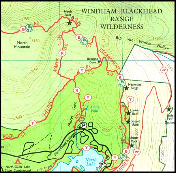
Soon after, we received our updated 2013 map set and discovered that the Survey Monument is no longer shown on the map. See the comparison of the same area from the 2001 map (where the Survey Monument is clearly labeled along the Escarpment Trail) and the 2013 map:

The description of the trail likewise omits any mention of the monument. According to the map, the survey monument should be located between the following two points of interest:
6.40 (miles): Badman Cave. To left, yellow-blazed Rock Shelter Trail leads to Mary’s Glen Trail and Schutt Road.
7.05: Reach junction with red-blazed Mary’s Glen Trail. Bear right and climb steeply, following blue markers.
So, of course, we are fascinated by this phantom “Survey Monument” and would love to have more information (and to find it, whatever it might be, for ourselves)! The only reference to it that we’ve been able to find is the following, from someone else who seems just as confused as we are (and who actually visited the approximate area, searched, and found nothing):
Views from the Top Forum - Escarpment Trail Survey Monument?
I will contact the Trail Conference and will update my blog if I discover anything. Please leave a comment if you have any information or ideas about this monument!
One further comment concerning the maps: they are excellently detailed durable (Tyvek) maps from a great trail organization. I doubt you’ll find any better reference for hiking and exploring in the NY/NJ/CT area. But I do wish the cartographers hadn’t removed the NGS/USGS triangulation stations from the newest versions!
